
Remote Sensing: A Window to Observing Earth from the Sky
Introduction
Imagine being able to understand the condition of a forest, a river, or a city without physically going there—knowing which part of a farm is under water stress, how much polar ice is melting, or where a new wildfire has started. That is exactly what Remote Sensing does: a science that lets us obtain precise information about the Earth’s surface, oceans, and atmosphere without direct contact.
Today, remote sensing is one of the pillars of Earth sciences, natural resource management, smart agriculture, urban planning, and even national security. In this article, we take a comprehensive look at the concept of remote sensing, how it works, and its most important application areas.
What Is Remote Sensing?
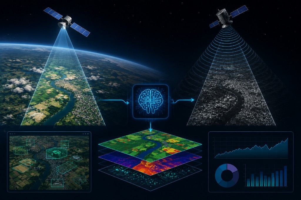
Remote sensing is the process of collecting information about an object or phenomenon without direct physical contact. This is usually done by recording electromagnetic energy reflected or emitted from the Earth’s surface using sensors mounted on satellites, aircraft, or drones.
Simply put, the process includes several main steps:
- Energy source – usually sunlight illuminating the Earth’s surface.
- Interaction with the surface – reflection, absorption, or emission of energy by vegetation, water, soil, or built structures.
- Sensor – a device that records the reflected energy.
- Processing and interpretation – converting raw data into usable information.
Types of Remote Sensing
Passive Remote Sensing
In this type, the sensor records naturally available energy (mainly sunlight). Optical satellite cameras such as Landsat and Sentinel are examples of this category.
Active Remote Sensing
In this method, the system emits its own energy (such as radar or laser waves) and measures the return signal. Synthetic Aperture Radar (SAR) and LiDAR are among the most important examples, with the major advantage of working at night and under cloudy conditions.
Key Concepts in Remote Sensing
1. Electromagnetic Spectrum and Spectral Bands
Understanding how different materials (water, vegetation, soil, metal) behave across wavelengths (visible, infrared, microwave) is the foundation of satellite image interpretation.
2. Image Resolution
Four types of resolution matter in remote sensing:
- Spatial resolution: the smallest detail detectable in an image.
- Spectral resolution: the number and width of recorded spectral bands.
- Temporal resolution: the time interval between two consecutive satellite passes over the same area.
- Radiometric resolution: the sensor’s sensitivity to differences in energy intensity.
3. Major Satellites and Platforms
Familiarity with widely used satellites such as the Landsat series, Sentinel (Copernicus programme), MODIS, and very high-resolution commercial satellites such as Planet and Maxar.
4. Vegetation and Environmental Indices
Indices such as NDVI (Normalized Difference Vegetation Index) for assessing plant health, or similar indices for monitoring water, soil moisture, and snow cover, are among the most widely used analytical tools in this field.
5. Image Classification and Machine Learning
Today, satellite image processing is tightly linked with machine learning and deep learning—from land-use classification to automatic detection of urban change or deforestation.
6. Radar Remote Sensing (SAR)
Because of its ability to penetrate clouds and operate day and night, Synthetic Aperture Radar is especially important for monitoring land subsidence, floods, and even millimetre-scale ground motion (using InSAR interferometry).
7. Practical Applications
- Precision agriculture: monitoring crop health and optimizing water and fertilizer use.
- Disaster management: tracking floods, wildfires, earthquakes, and related damage.
- Climate change monitoring: measuring glacier melt, sea-level rise, and temperature change.
- Urban planning: analyzing city growth and land use.
- Forestry and environment: monitoring deforestation and biodiversity.
8. Analysis Software and Tools
Geographic Information Systems (GIS) such as QGIS and ArcGIS, together with cloud platforms such as Google Earth Engine, make it possible to process large volumes of satellite data without heavy local infrastructure.
Conclusion
Remote sensing is no longer merely a specialized tool for academic researchers; it has become a technology that plays a key role in everyday decisions made by farmers, municipalities, relief organizations, and private companies. With the expansion of commercial satellites and cloud processing tools, access to this technology is becoming easier and more affordable every day—and a bright future lies ahead for its applications.