
Drone Photogrammetry: From Aerial Photos to Precise 3D Models
Introduction
Until a few years ago, producing an accurate map of an area or building a 3D model of a construction site was slow and expensive work that usually required aircraft equipped with heavy cameras. Today, with just a drone and a standard camera, you can capture hundreds of images of an area in minutes and generate a precise 3D model of the terrain. This capability comes from combining two technologies: drones and photogrammetry.
Drone photogrammetry now plays a major role in surveying, civil engineering, agriculture, mining, and even archaeology. In this article, we introduce photogrammetry, how it works with drones, and the key topics in this field.
What Is Photogrammetry?
Photogrammetry is the science of extracting geometric and spatial information (such as distance, area, volume, and elevation) from photographs. The core idea is that if an object is photographed from multiple angles with sufficient overlap, mathematical analysis of those images can reconstruct the 3D positions of points on the object—the same principle the human eyes use to perceive depth and distance.
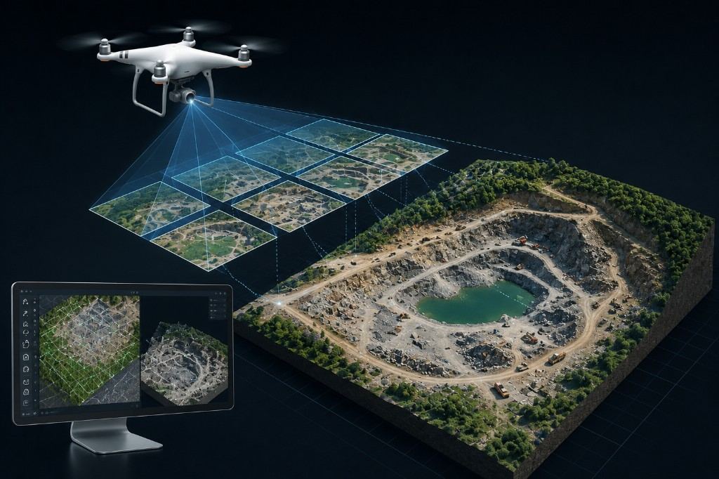
Combined with drones, an operator can collect tens to hundreds of highly overlapping aerial photos in a short flight, which are then processed in specialized software and converted into surveying products.
Overall Workflow
- Flight planning – defining the route, flight altitude, and image overlap percentage.
- Aerial photography – automated drone flight along a predefined path.
- Ground Control Points (GCP) – surveying precise coordinates of selected ground targets to improve final model accuracy.
- Image processing – matching images and reconstructing a 3D model in software.
- Output generation – producing maps, models, and final reports.
Key Concepts in Drone Photogrammetry
1. Forward and Side Image Overlap
Final model accuracy depends strongly on overlap between consecutive images (Front Overlap) and between adjacent flight lines (Side Overlap). Overlap of about 75–85% is commonly recommended for precise results.
2. Ground Control Points (GCP)
Using ground markers with precise GPS coordinates sharply reduces spatial error and can improve output accuracy from meters down to centimeters.
3. Dense Point Cloud
After initial processing, the software generates millions of 3D points that represent the real ground surface and objects in high detail; this point cloud is the foundation for many later analyses.
4. Digital Surface and Terrain Models (DSM and DTM)
A DSM (Digital Surface Model) shows surface elevation including buildings and vegetation, while a DTM (Digital Terrain Model) represents bare ground only (without trees and structures). Distinguishing the two is critical for many engineering analyses.
5. Orthomosaic
One of the most useful photogrammetry outputs is the orthomosaic: an aerial map corrected for camera-angle and terrain-related distortions, with a uniform scale across the image so measurements can be taken directly from it.
6. Volume Calculation and Engineering Uses
Drone photogrammetry enables accurate volume calculation for soil, rock, or material stockpiles in mines and construction sites—work that previously required time-consuming ground surveys.
7. Photogrammetry Processing Software
Leading tools include Pix4Dmapper, Agisoft Metashape, and DJI Terra, which automate conversion of raw images into surveying products.
8. Drone and Sensor Types
Choice of drone (fixed-wing or multirotor) and camera type (standard RGB, multispectral, or thermal) depends on project goals; for example, multispectral cameras are used in precision agriculture to compute vegetation indices.
9. Practical Applications
- Surveying and civil engineering: topographic mapping and construction progress monitoring.
- Mining: extraction volume calculation and pit-wall monitoring.
- Precision agriculture: crop-health monitoring and irrigation planning.
- Disaster management: rapid damage assessment after earthquakes or floods.
- Archaeology and cultural heritage: precise 3D documentation of historic sites.
Conclusion
Drone photogrammetry has closed the gap between traditional surveying and modern technology. At a far lower cost and in less time than conventional methods, accurate 3D models and maps can be produced. As drones, sensors, and processing software continue to advance, this technology keeps expanding across many industries.